EagleWind Drone Sevices provides aerial and ground data that helps you to stay connected with your project without ever stepping on-site, helping you win bids, keep projects on schedule, and update all stakeholders on project progress.
- Keep projects on schedule, report progress, and efficiently manage logistics with greater insight into site reality.
- Increase trust with your clients and stakeholders by sharing an accurate digital reconstruction of your job sites and visual documentation of every stage of your construction project.
- Decrease employee time-on-site and deliver accurate topographic maps in hours.
- Conduct remote inspections by comparing aerial maps to design-plans.
- Save time, improve communication, reduce costs, and eliminate safety concerns.
- Accurately measure earth-moving needed to reach finished grade.
- Capture and process accurate drone-based elevation data in a matter of hours.
- Export data to your engineering teams’ existing software resources (JPG, GeoTiff, OBJ, +LAS, XYZ, SHP, DXF)
Aerial imagery now fits the budget for any size job; simply tell us about your project, and we’ll take care of the rest. Contact Us today!
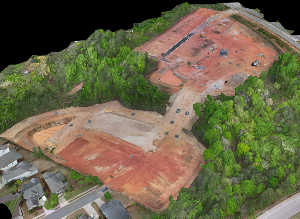
Aerial and ground data allow you to stay connected with your project without ever stepping on-site. 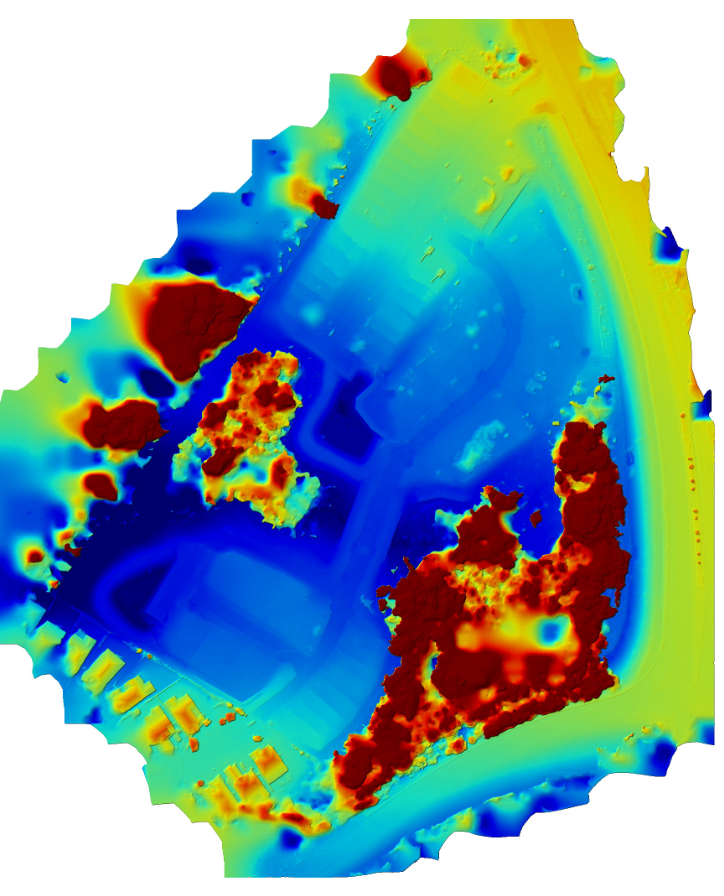
Capture and process accurate drone-based elevation data in a matter of hours. 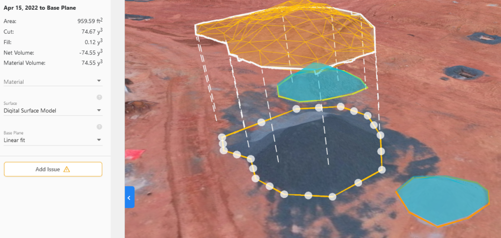
Keep projects on schedule, report progress, and efficiently manage logistics with site reality. 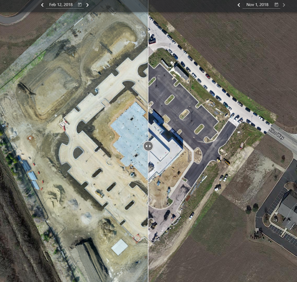
Side by Side Comparison: Compare project maps side-by-side to evaluate change over time 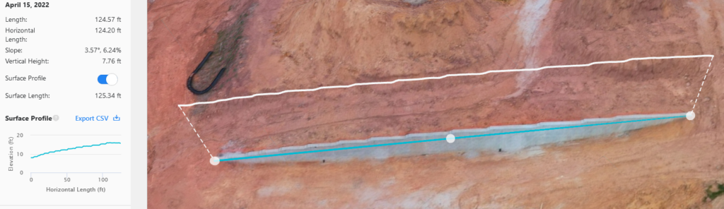
Conduct remote inspections by comparing aerial maps to design-plans. 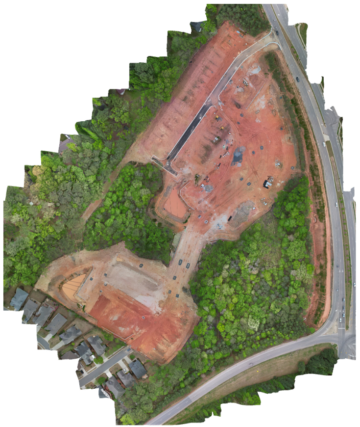
Increase trust with your clients by sharing an accurate digital reconstruction of your job site.